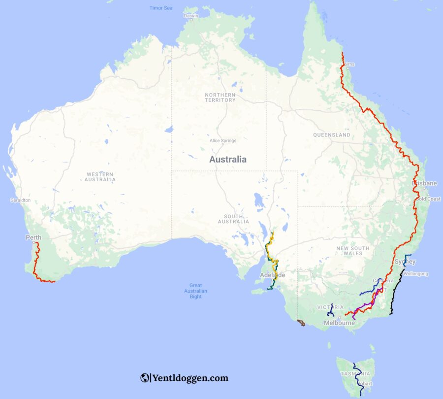
A travel guide to Australia’s longest hiking trails (250+km)
Some people like to go for walks, others like hikes, and some can’t get enough of thru-hikes. As for Australia’s long-distance walkers, a stroll in the park just isn’t sufficient. People with a true heart for hiking are always looking for longer hikes. This travel guide to Australia’s longest hiking trails is sorted from longer to shorter walks. The guide only looks at 250+ km hikes and isn’t for the faint-hearted. We discuss the best times to walk and give you all the essential information you need to get going. Put your walking boots on and start exploring the long-distance hiking trails of Australia.
1. Bicentennial National Trail:
- Total distance: 5,330 km (3312 miles)
- Duration: 265 – 350 days.
- Where: Victoria, New South Wales & Queensland
- Start Point: Cooktown, Queensland
- End Point: Healesville, Victoria
The Bicentennial National Trail is Australia’s longest hiking trail. Originally known as the National Horse Trail, the Bicentennial National Trail officially opened in November 1988. The trail follows the pathways of early pioneers, linking stock routes, postal lines, bush tracks, country roads, and fire trails. Along the way, it highlights the relevant historical sites and artifacts. Although the BNT was initially designed as a horse trail, it is now popular amongst hikers and cyclists.
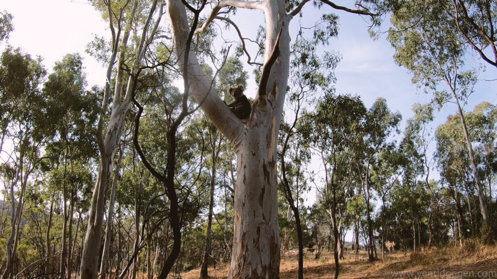
The course follows the length of the Great Dividing Range, linking eighteen National Parks and more than 50 state forests along the Australian East Coast. As the trail starts in the tropics of Queensland and ends in the countryside of Victoria, it is an ideal path for those interested in Australia’s variation of fauna and flora. The Bicentennial National Trail consists of 12 sections. Every unit is about 400 to 500 kilometres long and comes with a complementary guidebook.
Best time to walk the Bicentennial National Trail:
Starting the Bicentennial trail is possible anywhere between April and October. However, for the best conditions throughout the hike, it is best to start walking in May or June. In the latter, you’ll have winter in the North and summer in the south, with minimal chance of snow and bushfires along the way.
2. Heysen Trail:
- Total distance: 1,200 km (711 miles)
- Duration: 55 – 75 days
- Where: South Australia
- Start Point: Parachilna Gorge, Flinders Ranges
- End Point: Cape Jarvis, Fleurieu Peninsula
The Heysen Trail was officially opened in 1992 and is named after Hans Heysen, who fought to preserve the great red and white gum trees of the Adelaide Hills. The trail’s scenery is one of the best in South Australia, as the trail passes through cliffs, farmland, vineyards, coastal areas, pine forests, native bushland, and historic towns. Some of the highlights along the way include the Flinders Ranges, Mount Remarkable National Park, Crystal Brook, Burra, Kapunda, the Deep Creek Conservation Park, and the Adelaide Hills.
Although the Heysen Trail is famous as an end-to-end walk, it is also popular for one-day and multi-day hikers completing one or more of the 61 total sections. Hiking the trail is free; however, you’ll need to pay for camping and accommodation fees along the way. The non-for-profit volunteer organisation, Friends of the Heysen Trail, looks after the trail’s maintenance and offers plenty of helpful information.
Best time to walk the Heysen Trail:
Hiking the Heysen Trail is best done between April and October, outside fire danger season. The best starting months are August and September if you walk north to south. The sun is at your back, the weather is ideal, and the rainwater tanks should be full from the winter months. If you decide to walk south to north, the best months are April and May. As you start walking to the hotter mid-north in early winter, the temperatures should be mild during the entire hike.
3. The Bibbulmun track:
- Total distance: 1,003 km (623 miles)
- Duration: 50 – 65 days
- Where: Western Australia
- Start Point: Kalamunda, Perth
- End Point: Albany
The 58-section Bibbulmun Track is one of Australia’s longest and best-known hiking trails and was officially opened in 1988. Bibbulmun comes from the Indigenous word for the Perth area, the track’s starting point. The route passes through diverse forests, mist-shrouded valleys, giant granite boulders, and coastlines. Highlights are the Murray River Valley, the Tingle forest near Walpole, and the Karri forests.
As the Bibbulmun Track is a walkers-only trail, no wheeled vehicles are permitted. Long-distance cyclists can attempt another route between Perth and Albany called the Munda Biddi Trail. Along the Bibbulmun Track, there are 49 campsites, which are spaced a day’s walk apart. Sleeping between these campsites isn’t allowed since the trail passes through many stunning national parks. The sign for the track is a Rainbow Serpent (Wagyl), an Indigenous Dreamtime Creator.
Best time to walk the Bibbulmun Track:
The timeframe to walk the Bibbulmun Track is pretty broad, as only walking during summer is not recommended. Moreover, every season has its perks. Winter (June to August) is ideal, as the day temperatures are very mild, and the track isn’t bustling. In Spring (September to November), it is the wildflower season. If you rather walk in Autumn (April and May), it is better to walk from Albany to Kalamunda as you walk away from the approaching winter in the south.

4. Mawson trail:
- Total distance: 900 km (553 miles)
- Duration: 40 – 55 days
- Where: South Australia
- Start Point: Adelaide Hills
- End Point: Blinman, Flinders Ranges
The 13-sections Mawson Trail originates from a handful of cycling fanatics in 1990. Although the trail is often seen as the long-distance cycling option for the Heysen Trail, it is accessible for hikers. The Heysen Trail and Mawson Trail share similar stops and paths multiple times. Close to 900 km, the Mawson trail takes you along various state forests, national parks, and little-used country roads. It ends its journey in the Australian outback.
The Mawson trail is ideal for seeing some of South Australia’s finest rural areas. Highlights include the historic towns of Lobethal, Birdwood, Kapunda, and Burra. Furthermore, it passes through the world-renowned Barossa wine valley, the Bundaleer Forest, and its end destination, the Flinders Ranges. The trail markers for the Mawson trail are purple and easy to follow. You will find one at each intersection and even in between for reassurance.
Best time to walk the Mawson trail:
Starting times for the Mawson trail are very similar to the Heysen Trail. However, since the track is designed to walk south to north, the ideal starting months are April and May. You will get the last good summer days in the south and the cooler winter days in the hotter mid-north.
5. Australian Alps Walking Track:
- Total distance: 655 km (424 miles)
- Duration: 35 – 45 days
- Where: Victoria, New South Wales & ACT
- Start Point: Walhalla, Victoria
- End Point: Tharwa, ACT
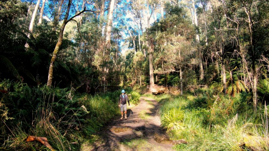
The Australian Alps Walking Track is a 16-sections hike and an extension of the older Victorian Alpine Walking Track, established in the 1970s. As the track doesn’t transit through any nearby town or settlements and follows the complete Australian Alps, it is one of the most complex tracks on our list. In addition, hikers have to depend heavily on their navigation skills as not all sections are well-marked. Yet, it is one of the most rewarding hikes in Australia to complete.
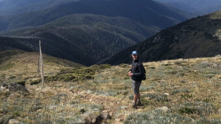
The highlights along the Australian Alps Walking Track are the Alpine National Park and the Kosciuszko National Park. The trail ascends and travels across the peaks of Mount Bogong, Mount Kosciuszko, and Bimberi, the highest points of Victoria, New South Wales, and ACT. According to early walkers, the Victorian part is well worth the effort as it follows spurs and ridges. In New South Wales, it gets a little less imaginative as it follows plenty of fire trails.
Best time to walk the Australian Alps Walking Track:
The Australian Alps Walking Track crosses the Australian Alps, which is why you want to avoid walking during winter. The best time to start your hike will be between October and April. It is possible to trek during mid-summer, although you must consider the risk of bushfires and empty water sources. The temperature in the Australian Alps can vary all year round between below-freezing and about 40 degrees. It is common to wake up in the snow one day and sweat your pants off the other day.
6: Great South Coast Walk:
- Total distance: 660 km (410 miles)
- Duration: 30 – 45 days
- Where: New South Wales & Victoria
- Start Point: Bundeena, New South Wales
- End Point: Mallacoota, Victoria
The 15-sections Great South Coast Walk is Australia’s newest hiking trail. The walk started as a blog post about a 3-month self-discovery journey named “time to walk, time to contemplate.” The diary by the Briese family describes the trek from Sydney to Mallacoota as one of the world’s most diverse stretches of coastline. Since then, the walk quickly became a trend on the internet forums of Australia’s long-distance hikers. Since it is one of the few hiking trails in Australia that follows an entire coastline, the walk is trying to get recognised as an official walk. The website for the blog posts is named Gang-Gang, after an Australian Cockatoo.
Best time to walk the Great South Coast Walk:
Because of the Great South Coast Walk’s coastal character, it is possible to hike the track all year round. The best time to walk is during summer as it allows you to swim along the way, with the sea breeze keeping you cool. Spring is the calmest period on the track, as the schools are still running. Winter comes with mild days and cold nights, which is sometimes a good thing on the trail. However, the downside is that swimming is less enjoyable than during summer.
7. Tasmanian Trail:
- Total distance: 480 km (296 miles)
- Duration: 20 – 30 days
- Where: Tasmania
- Start Point: Devonport
- End Point: Dover
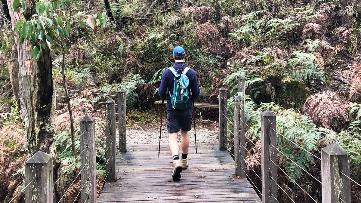
Inspired by the Bicentennial National Trail, which travels across mainland Australia, the Tasmanian Trail crossing Tasmania opened in 1988. Although they initially planned the route for horse riders and cyclists, it is possible to hike the entire path. All 15 different sections are strategically placed, most ending at a campsite or a town. The quality of the camps varies, but generally, these consist of three-sided huts, a water tank, toilets, and cleared tent spaces.
The Tasmanian Trail passes through state forests, nature reserves, and historic towns. It often skips the valleys to seek the ridge lines with many scenic lookouts. Highlights on the track include the Great Western Tiers, the Derwent River, and the Huon River. The towns of Sheffield, Deloraine, New Norfolk, and Dover are just a small selection of all the Tasmanian towns along the way. Volunteers and the Tasmanian State Government Forestry Department manage the trail.
Best time to walk the Tasmanian Trail:
Winters in Tasmania are cold; there is a chance of snowfall between June and September. Moreover, when that snow melts again, it makes crossing some of the rivers much harder. The best time to hike the Tasmanian Trail is between mid-October and mid-March. In these months, there shouldn’t be any snow, less rainfall, and warmer temperatures.
8. Hume and Hovell Track:
- Total distance: 426 km (273 miles)
- Duration: 20 – 30 days
- Where: New South Wales
- Start Point: Yass
- End Point: Albury
The Hume and Hovell track allows hikers to rediscover the trail of explorers William Hovell and Hamilton Hume on their expedition to Port Phillip in 1824. On the 5-sections thru-hike, hikers see diverse wetlands, forestry, and farmlands and have to do some rock-scrambling. Along the way, there are three well-developed trailheads and plenty of easy walk-in campsites, one a little more scenic than the other. The trail is well-maintained and well-signed.
Highlights on the track are the views over the western face of the Snowy Mountains in Woomargama National Park and the spectacular limestone formations of Carey’s Cave in the Wee Jasper Valley. Furthermore, it climbs the Big Budgingi Hill and passes the Blowering Dam Wall and the Pompey Pillar. The Hume and Hovell track even includes a ferry crossing at the Burrinjuck Dam.
Best time to walk the Hume and Hovell Track:
The best times to walk the Hume and Hovell track are from September to November and March to May. It is possible to hike between May and September, although there is a high likelihood of snowfall along the way. Summer comes with bushfire risk, heat, and drought, making hiking during summer a little more challenging but not impossible.
9: Great Dividing Trail:
- Total distance: 304 km (189 miles)
- Duration: 15 – 20 days
- Where: Victoria
- Start Point: Bendigo/Mount Buninyong/Bachhus Marsh
- End Point: Bendigo/Mount Buninyong/Bachhus Marsh
The Great Dividing Trail is a hiking path different from all others on this list of Australia’s longest hiking trails. Officially called the Great Dividing Trail Network, the track combines multiple walking trails. From Daylesford to the east, there is the 87km Lerderderg Track, finishing in Bacchus Marsh. From Daylesford to the west, the track passes through the 52km Wallaby Track and the 43km Eureka Track to Mount Buninyong. Finally, from Daylesford to the north, the dividing Trail heads into the 58km Dry Diggings Track and the 61km Leanganook Track to end in Bendigo. Now, except for the Lerderderg Track, all these tracks combined form the Goldfields Track.
Initially, the trail was intended for hikers. However, over the years, it has proven more appealing for mountain bikers and is being further designed for that intent. The Great Dividing Trail Network tracks pass through many populated areas, making it a perfect option for different day walks.
Best time to walk the Great Dividing Trail:
Hiking the Great Dividing Trail, in whichever direction you go, is possible all year round. Yet, winters in central Victoria can get pretty cold, and summers get pretty hot. Spring is best as nature is flowering, and you escape the more extensive rainfall from autumn.
10. Great North Walk:
- Total distance: 250 km (155 miles)
- Duration: 12 – 18 days
- Where: New South Wales
- Start Point: Macquarie Place, Sydney
- End Point: Bicentennial Park, Newcastle
The Great North Walk was officially opened in 1988. However, the initial name for the trail was Sydney to Hunter Project. It was later renamed after the first road from the Hunter Valley to Sydney, the Great North Road. Hikers that want to thru-hike the walk can choose between a 12 or 18-day itinerary. In both cases, there are campsites a day’s walk apart. If camping isn’t your thing, the Great North Walk also has an Inn to Inn option. Inn-to-Inn walkers can choose between an 8, 15, and 16-day itinerary, with different accommodations from B&B, motels, and caravan parks along the way.
Highlights on the trail’s southern end include the heritage homes of Hunters Hill, the Lane Cove National Park, and Berowra Creek. Further north, the track passes the Ku-ring-gai Chase National Park and heads to Brisbane Water National Park. The way is maintained by New South Wales National Parks and Wildlife Service and State Forests. It is well-signed during the hike.
Best time to walk the Great North Walk:
Because of Sydney’s and Newcastle’s locations, it is possible to walk the Great North Walk all year round. In mid-summer, the day temperatures are a little on the high side, and in June, the rainfall is the highest.
11. Great South West Walk:
- Total distance: 250 km (155 miles)
- Duration: 12 – 15 days
- Where: Victoria
- Start Point: Visitor Centre, Portland
- End Point: Visitor Centre, Portland
Last on our list of Australia’s longest hiking trails is the Great South West Walk. This 15-section hike is the only loop trail in this list and was established in 1981. Along the way, there are 14 campsites, each about 10 to 20km apart, and although the walk is free, all camps charge a small fee. The Great South West Walk traverses forests, river gorges, high cliff tops, and various bays and is a moderate hike.
Highlights on the Great South West Walk include the Lower Glenelg National Park, the Mount Richmond National Park, and the Cape Nelson State Park. A shorter version is available at the Lower Glenelg River Conservation Park. The track is maintained and promoted by the Friends of the Great South West Walk and Parks Victoria.
Best time to walk the Great South West Walk:
Due to its coastal character, it is best to avoid the cold winter months on the Great South West Track. September to April is the best time of year for hiking. The sea breeze will keep the temperatures down during the hot summer months. Also, avoid hiking during school holidays as it will fill up the most popular campsites along the way with non-hikers.
Have you ever walked one of Australia’s longest hiking trails, or are you planning on doing one? Let us know in the comments below. Moreover, if you have questions or remarks on our travel guide to Australia’s longest hiking trails, please send us a message! 🙂
Are you enjoying reading our travel guides? Please let us know in the comments below! If you need help or have questions about exploring this fantastic world, check out all our blogs and vlogs or contact us through the contact page. We are happy to help with all your travel needs and questions!
To keep up-to-date with future adventures and travel guides, follow us on Facebook or just simply check this website regularly. We can’t build this platform without our readers, so we thank you for your continued support. Stay tuned for many more adventures to come!