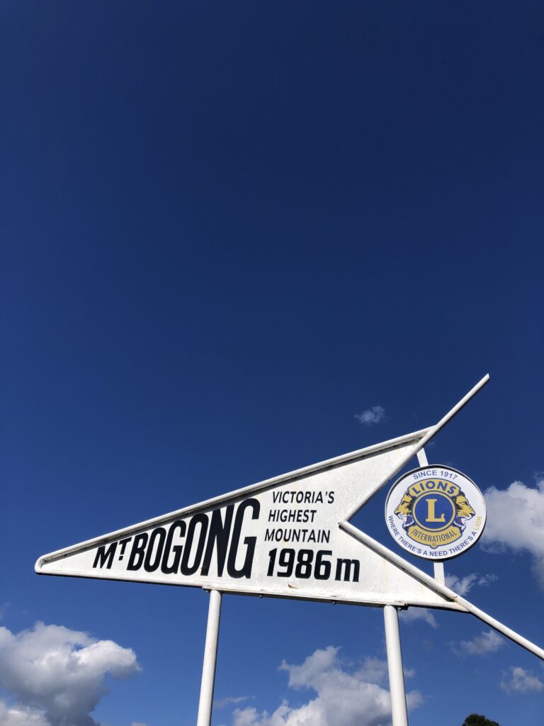
Mt Bogong – The complete guide to summiting Victoria’s highest peak
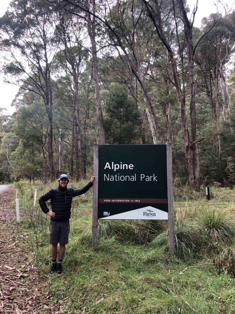
Mt Bogong in the Victorian Highlands should be on everyone’s expedition list. Part of the Australian Alps, or Alpine National Park, this mountain dominates much of the horizon and has exceptional views across the mountain range. It is the perfect mountain to gain Alpine experience and taste the Australian Alps’ majesty. But summiting Victoria’s highest mountain takes preparation, all of which I have included for you in this guide! A challenging but rewarding climb awaits you and the opportunity to explore some history through a few of the Alpine Huts.
A popular trail, you can choose to summit in one day or extend your climb and camp overnight on the mountain. While the paths may seem short, you must consider the elevation gained over these kilometres – around 1300 meters, to be exact. Therefore, a moderate fitness level is required for this climb, as well as the proper preparation and gear. Before climbing to the summit, a few days of planning and prepping are in order. Other climbers may not always be there to help when needed, so you must be self-sufficient and know what you take on. We saw the effects of being unprepared on the mountain, resulting in us rationing out our supplies to a very exhausted and dehydrated climber we met just before the summit. This highlighted how many people underestimate the challenge and effectively what the body needs when attempting such a challenge. Thus, this guide to summiting Mt Bogong was born to make your preparation and climb the best it can be.
How to get to Mt Bogong:
A short drive away from the stunning alpine town of Bright, there are many great things to do in this region. Mt Bogong is located in Tawonga and is part of the Australian Alpine National Park. The closest capital city is Melbourne, 370km away. The shortest drive to get here is just over 4.5 hours on the National Highway M31; however, allow ample time, especially if driving in winter.
Public Transport
While public transport is an option to get here, it is not highly recommended. Not only does it take much longer, but it also costs around $150-$200 one way. However, if it is the only way you can get here, it is better than not getting here at all!
Where to stay around Mt Bogong:
There are a few options when deciding where to stay around Mt Bogong. The closest towns to the mountain are Mount Beauty (12km away), Tawonga (15km) and Bright (31km). You can find accommodation in all three of these towns (even a backpackers hostel in Bright), or you can choose to free camp at the mountain base at the Mountain Creek Campground. We recommend this option for the night before (to get a super early start) or the night after the climb. Furthermore, we suggest setting up your tent before climbing if you choose to stay the night of. That way, when you get down, all you need to do is eat, then crawl into your sleeping bag! You will not want to fuss around your tent after a challenging 18-20km climb like this.
Quick notes on visiting Mt Bogong:
Elevation gained: 1282 meters.
The time needed: Allow 7-9 hours for a day trip or two half-days for camping. We recommend starting before 8:30 am for a day hike.
Difficulty: Hard
Location: Alpine National Park, Victoria
Closest Town: Mt Beauty
Toilets: Available; read more below.
Best time: During winter, this becomes a grade 5 hike and can be extremely dangerous. We recommend climbing in spring or autumn to avoid extreme weather.
Hiking trails on Mt Bogong:
Three different trails will take you to the summit of Mt Bogong. Each offers you a different experience, but ultimately all lead to the same place. Choosing which route you take is essential, as only one of them can be accessed without a 4WD. But you do not have to choose just one! You can also make a circuit out of two of the trails. That way, you can experience the views of two different mountain sections.
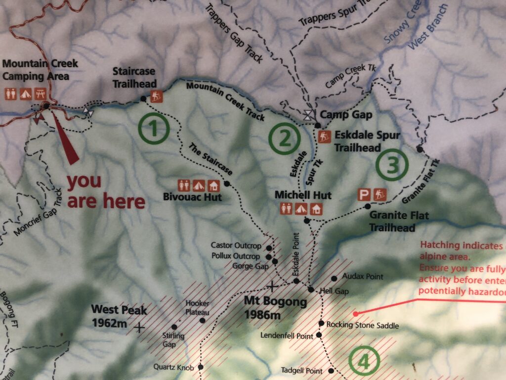
The Stair Case Spur:
Distance: 8km from Mountain Creek Campground; 6km from the trailhead.
A grade 4 hiking trail, it is the most demanding ascent trail of the three. Starting at the Mountain Creek Campground, it is a further 2km walk to the trailhead if you do not have a 4WD. If you do have a 4WD, you can drive through to the head. One way, the trail is around 8km long from the campground, 6km of which is the staircase itself. Don’t let that fool you; it may very well be the most challenging 6km of your life. Bivouac Hut is around the halfway mark and offers the perfect spot for rest and refuelling. Until the hut, most of the trail is through dense trees and relentlessly steep, with sadly not much of a view. As it is a forest, make sure you look out for snakes; just before the hut, I almost stepped on one myself.
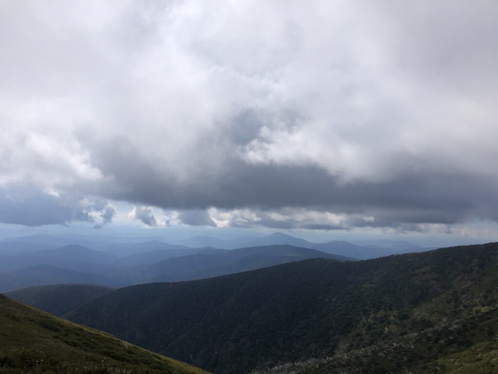
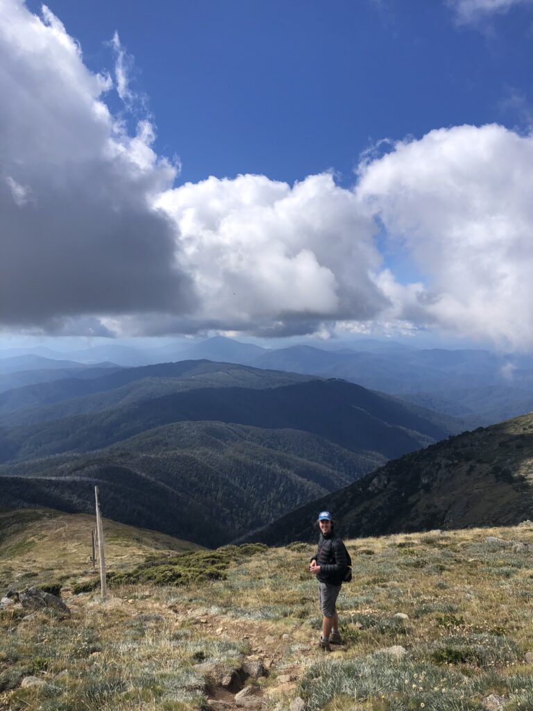
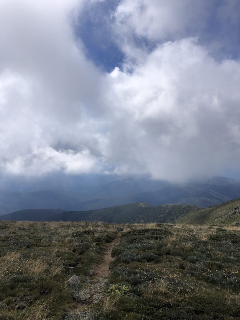
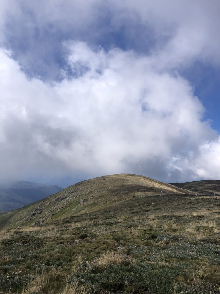
After the hut, though, the trail becomes less steep but still challenging. A few more kilometres and you will reach the tree line. This is where you need your common sense. If the weather looks like it will take a turn for the worst, or visibility is poor, do not attempt the summit. There is no protection past the tree line, and you can quickly lose the path in both directions, which is extremely dangerous. Only continue to the summit if the weather is clear enough. You will now find yourself with some of the best views in Victoria past the treeline. They get better the closer you get to the final climb to the summit. Just a quick tip, when you reach the intersection between the Staircase Spur and two other paths on the plateau, take the right path that will lead to the actual summit. You would be surprised how many accidentally take a left, which leads away from the peak.
Granite Flat Walking Track:
Distance: 3.5km to the summit from the trailhead.
The shortest track to the summit; however, a pretty challenging 4WD is necessary to reach the trailhead, which begins at the end of the Granite Flat Veichal Track. To get to the Granite Flat Spur, you must follow Camp Creek Road, which begins at the start of the Eskdale Spur. Follow the road until you reach the winter gate, where you will make a right-hand turn onto Granite Flat Spur Road. Drive a further 3km, and you will reach the start of the track! The trail features some more stunning sections of the Eskdale S .lopur trail, but fewer kilometres are needed to summit!
Eskdale Spur Walking Track:
Distance: 4km
The debatably most beautiful of Mt Bogong’s hiking trails, the Eskdale Spur takes you through various vegetation on your way up the mountain in a less exhausting accent than the Staircase. To get to the trailhead, you will need a 4WD, although the tracks are usually well maintained; not a hard drive like that to Granite Flat. Access is via the Camp Creek Track and Trappers Gap Road. The trail finishes at Eskdale Point, 500m from the official summit. From this point, you will walk across the plateau, which in my opinion, is the most beautiful part of the entire hike!
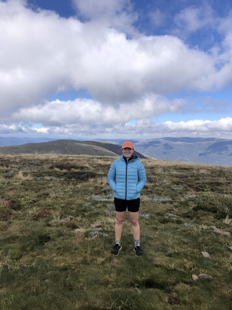
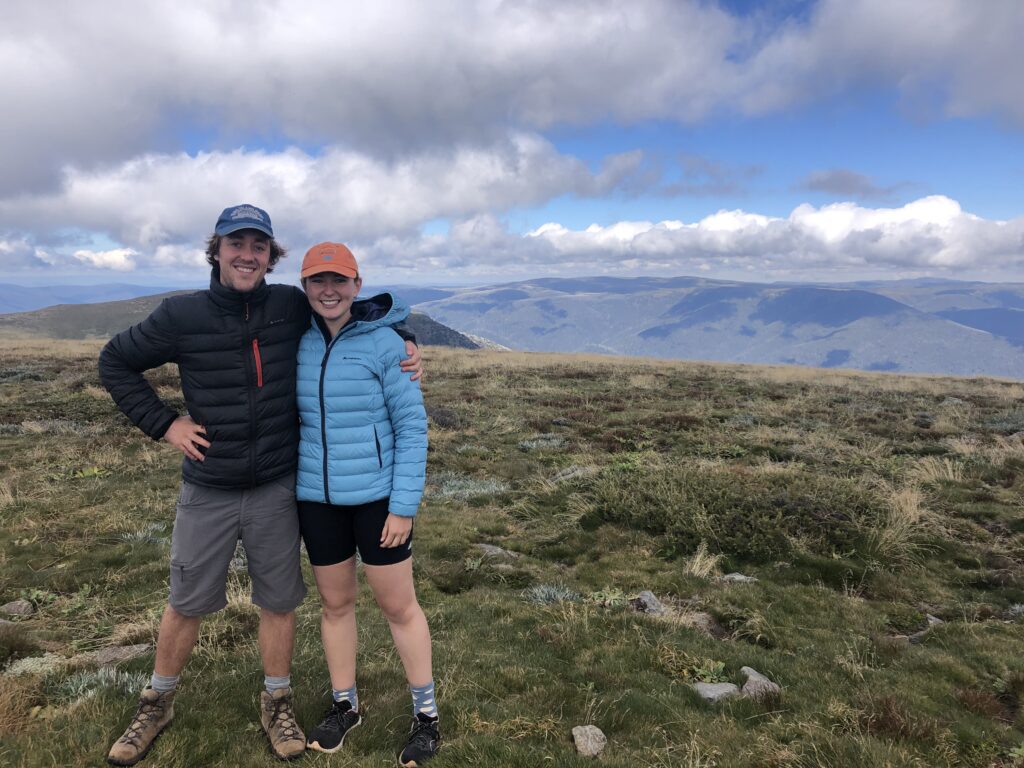
For the last 500m to or from the peak (depending on which direction you are walking), you can relax and take in all the beauty of the Alps without exhausting the rest of the trail. Take your time in these 500 meters to take it all in, and remember to get some good photos because you will be dreaming of this view for years to come. Eskdale Spur is also the recommended track for summiting during winter as it provides the quickest access to the peak and Cleve Cole Hut.
Best circuit for a day trip – Staircase and Eskdale Spurs circuit:
Distance: 21.4km from Mountain Creek Campground
We recommend making a circuit if you plan to summit Mt Bogong and return in one day. Ascend using the Staircase Spur, beginning from the campground or leaving your car at the trailhead. Instead of walking back down the same trail at the summit, head across the mountain to the Eskdale Spur trail. When you reach the bottom of the track, turn left and follow the connecting Mountain Creek track back to either the Staircase trailhead or the campground (depending on where you parked). You get to see the best of these fantastic trails in one trip, making the hike all the more rewarding to experience.

Toilets:
Every hiker’s worst nightmare – having to do number 2 on the trail. Never fear, the trail gods came through for me on this one, and there are two toilets (long drops) on the mountain! Located at the huts on the Eskdale and Staircase spurs, they are a welcomed relief for many. I recommend taking toilet paper in case it hasn’t been replenished in a while. Furthermore, toilets are available at the mountain’s base at the Mountain Creek campground.
Highlights:
- Magnificent views across the Alps
- Well-maintained trails and huts
- Toilets
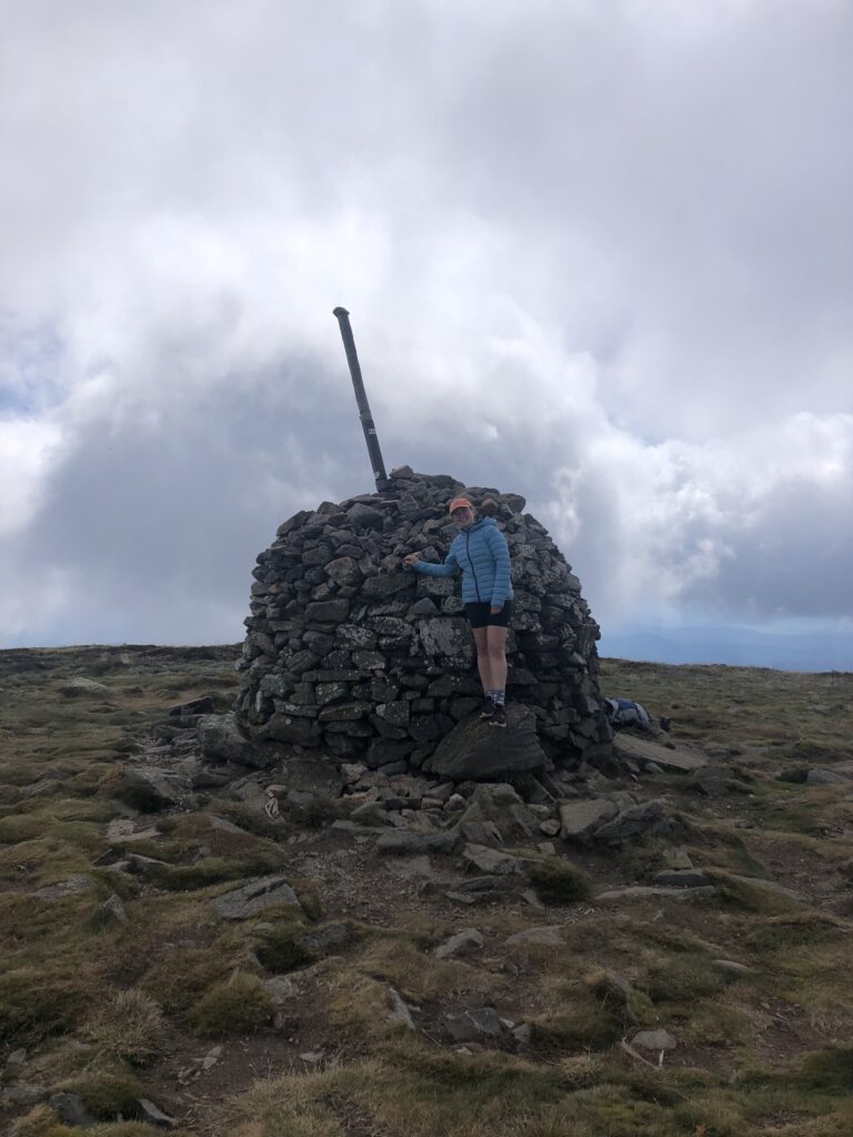
- Monument at the summit
- Likeminded people on the trail
Lowlights:
- Limited views for the first half of the walk
- No protection outside of the treeline
- Hard to access without a personal vehicle
Essential gear to hike Mt Bogong:
It would be best if you always were prepared for drastic weather changes when climbing into Alpine regions. Above the treeline, temperatures can be substantially less than at the mountain’s base, and conditions can change within a few minutes. Further, you need to have adequate food and water for this climb.
- Good quality trail shoes
- Jumper
- Raincoat (optional, however, recommended)
- Hat or beanie for the top
- Sunscreen
- at least 2L of water per person
- High energy snacks
- Camera (you need good photos at the top!)
- Hiking poles (optional but highly recommended)
- PLB (personal location beacon). There is no reception on the mountain, so having a PLB is recommended in an emergency.
- First Aid kit
The Huts on Mt Bogong:
Located on the mountain trails, Mt Bogong has three backcountry huts you can check out along the way. Used for emergency shelter by hikers, the huts have plenty of history to offer and are a welcoming place for a rest halfway up or down the mountain. Furthermore, toilets are available, so the huts are VERY relieving for many.
Cleve Cole Hut and camping area:
It is named after the titular skier who died in 1936 on an expedition across the Bogong High Plains to the summit. This hut has ample camping space and even boasts some magic in running water! Howman’s Falls is a nearby side trip from Cleve Cole Hut. The cabin is located about 4km from the summit of Mt Bogong and is a popular destination for campers staying overnight on the mountain.
Bivouac Hut and camping area:
Located on the Staircase spur, the Bivouac hut offers a welcomed resting place at the halfway mark of this trail. The cabin has magnificent views of the surroundings, the first on the ascent up the staircase. The surrounding camping ground is not 100% flat but is the last chance to camp on this trail before it becomes too rocky.
Mitchell Hut
Located on the Eskdale Spur, this hut is close to the summit and not too far from the treeline. A toilet and water tank are located here. Remember to treat the water before drinking it.
The hike to summit Mt Bogong is among Victoria’s most rewarding and challenging. With almost 1300 meters of elevation gain over a short distance, you must be adequately prepared with ample food and water to sustain yourself for the entire hike. Likewise, you also need the right gear to get you through weather changes, as the alpine country can be unforgiving if you come unprepared.
Are you enjoying reading our travel guides? Please let us know in the comments below! If you need help or have questions about exploring this fantastic world, check out all our blogs and vlogs or contact us through the contact page. We are happy to help with all your travel needs and questions!
To keep up-to-date with future adventures and travel guides, follow us on Facebook or just simply check this website regularly. We can’t build this platform without our readers, so we thank you for your continued support. Stay tuned for many more adventures to come!