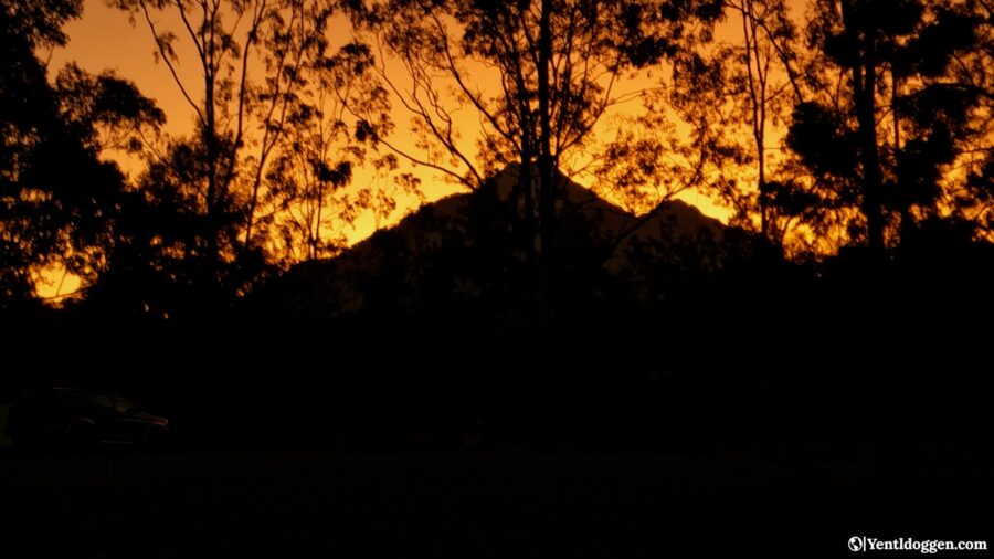
Mt Barney National Park – Travel Guide to the National Park with Seven Summits.
If you’re looking for an unforgettable weekend trip, consider visiting Mt Barney National Park. It’s only about 1 hour 45 minutes (~115 km) from Brisbane, making it an easily accessible getaway spot. As part of the Scenic Rim, this park has much to offer, including hiking, climbing, and swimming in freshwater rock holes. We recently visited the park on our 2023 Greater Brisbane Road Trip and loved it so much that we wanted to share our experience with you. Our Travel Guide covers everything from accommodation options to what to bring and what activities to do. We hope this post inspires you to visit Mt Barney National Park, as it truly is the perfect weekend escape.
How to get to Mt. Barney National Park:
Getting to Mt Barney National Park is easy with your own vehicle. Being so close to Brisbane and the Gold Coast, you can take main roads almost the whole way.
Coming from Brisbane, it takes just over 2 hours (~115 km) via State Route 93. From the Gold Coast, it is around 2.5 hours (~140 km) following State Route 90.
Sadly, there are no public transport options currently available that operate to Mt Barney National Park.
What do you need to take to Mt. Barney National Park?
- Good walking shoes.
- Lightweight, long sleeve clothing.
- Raincoat.
- Bathers and a quick dry towel to take on hikes.
- Small hiking/day pack.
- Hat and sunscreen.
- Camp gear (tent with rain sheet, warm sleeping bag, pillow).
- Food – check with your accommodation if a fridge and or cooking equipment is available before you go, as this will alter what you can bring.
- Cooking stove.
- Maps of the walking track you intend to do.
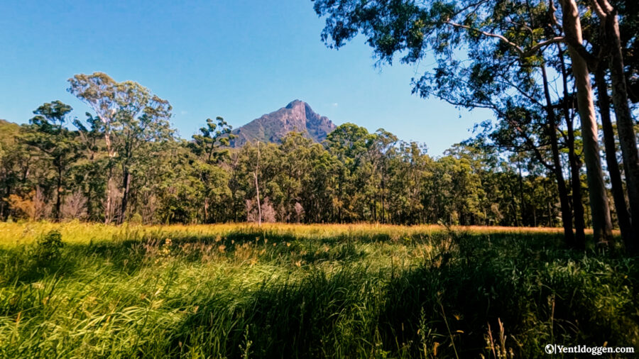
Why visit Mt Barney National Park?
Mt Barney National Park is embedded in a stunning part of the Queensland/New South Wales border called the Scenic Rim. If you haven’t heard of it, you have just entered the rabbit hole to start planning your trip! A hiker’s/climber’s dream, if you will—there is something for everyone in this park of seven summits ! You cannot go wrong with climbs, hikes, and freshwater rock holes all on offer. The popular trails include the titular mountain Mt Barney (which has multiple trailheads), Mt Maroon, the Upper and Lower Portals, and the Yellow Pinch Track.
Best time of year to go to Mt Barney National Park:
If you’re planning to visit Mt Barney National Park, it’s recommended to go during autumn or spring. These seasons are perfect because the weather is delightful, and it’s not as hot as it can get in summer. Winter can also be a great time to visit, but it’s more unpredictable. It’s best to avoid school holidays and long weekends as these times are usually busy, making it harder to find accommodations. Midweek is the best time to visit as it’s less crowded, allowing you to enjoy the park without worrying about the crowds.
Our trip:
If you’re just joining us, here’s a quick update on our journey so far. In July 2022, we finished our East Coast adventure from Melbourne to Darwin and landed jobs on Moreton Island. We fell in love with the island during a snorkel tour, but after eight months, we were ready to hit the road again. Luckily, our friends Kane and Jenna left their car for us to use for six weeks, so we took advantage of the opportunity and embarked on an amazing four-week road trip around the greater Brisbane area. Due to work constraints, we limited our travels to the Noosa Everglades in the north and Byron Bay in the south. We mapped out our points of interest on a personal Google map and reached Mt Barney National Park about halfway through our journey.
Come prepared:
These are challenging climbs. Mt Barney is well known for hikers and climbers going missing, so you need to come prepared. GPS, maps, and plenty of food and water are the essentials, and you should leave no later than 8 am for Mt Barney itself. Allow at least 10 hours, and gain as much information about the trail as possible before you go. If you are unfamiliar with such a challenging climb, Mt Maroon is a great option. While still very tough, it is much shorter and a great warm-up to Mt Barney.
Camping at Mt Barney National Park:
Camping is the best way to truly experience Mt Barney National Park. While more luxurious forms of accommodation are available, the best is still camping. We stayed at the Mt Barney Lodge and could not have had a better time. Being out of reception, we didn’t touch our phones (except for photos) for three days, and it was the perfect base from which to explore the park. The staff were also helpful and knowledgeable, giving us different hiking and climbing options that suited us and our time frame! Below are some of the accommodations on offer at Mt Barney National Park.
Hikes in Mt Barney National Park:
As detailed below, there are four formed walks/hikes in Mt Barney National Park.
Yellow Pinch Lookout:
Distance: 2km return | Difficulty: grade 4 | Time: allow 1 hour to return.
Begins at the Yellow Pinch Trailhead
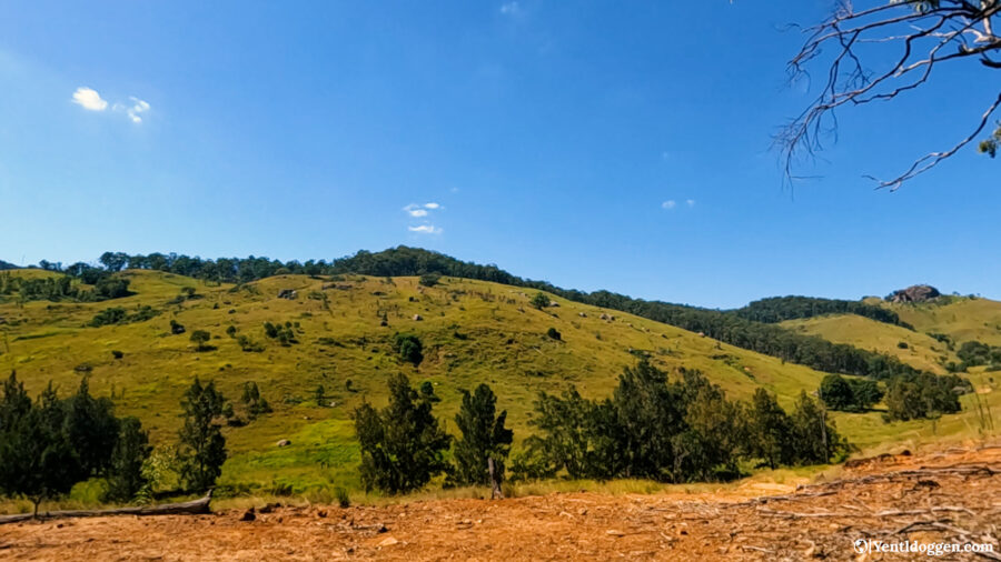
This is a great short walk to enjoy. Starting at the car park, there is a slight incline to endure but nothing too drastic, and you are well rewarded at the end. The Yellow Pinch Lookout is a natural lookout with gorgeous views of Mt Barney and the park. Enjoy this peaceful walk before taking a refreshing dip in the Yellow Pinch pool, just 200 meters from the car park.
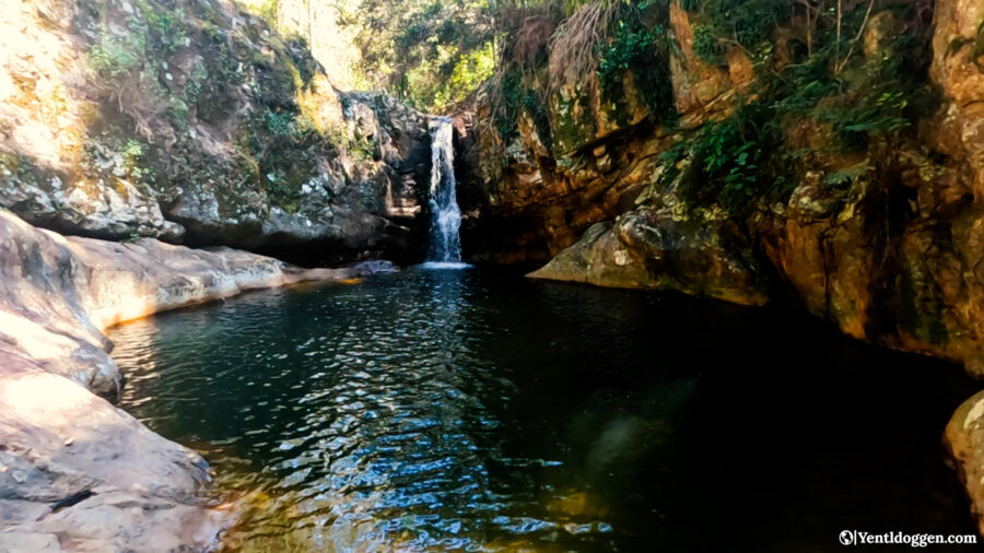
Cronan Creek Falls:
Distance: 12km return | Difficulty: grade 4 | Time: allow 4 hours return.
Begins at the Yellow Pinch Trailhead.
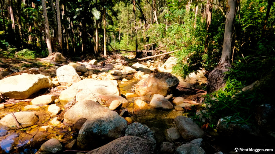
The Cronan Creek Falls walk might be long, but worth it! This is a great trail to stretch the legs on a flat trail with slight inclines that is mainly shaded thanks to the trees on either side. The path is a maintenance track up until the last 200 meters to the waterfall and plunge pool, so it is easy to follow. There are a few creek crossings, so you may need to remove your shoes if you want them to stay dry! Furthermore, you cannot miss the turn-off onto the waterfall, as there is a little sign pointing where to go on the left! The falls are great for a cold refreshing swim, but it is much colder than the other pools in the park, so be prepared!
If you want to extend this walk, on the way back, you can cut down from the second gate (the middle gate, as there are three gates on this trail) to the river and scramble around that way! There are plenty of pools you can swim in along the river, so this would be great for a hot day.
Lower Portals Track:
Distance: 7.4 km return | Difficulty: grade 4 | Time: allow 3 hours, including swimming
Begins from the Lower Portals Carpark.
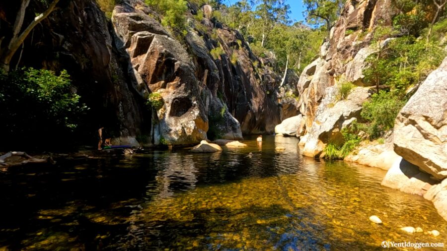
The Lower Portals is a must-visit location in Mt Barney National Park. The track is very up and downhill, so bring plenty of water as there isn’t much shade either. Keep following the path all the way to the creek crossing, but don’t be fooled! This little creek isn’t the infamous Lower Portals. Many people see the creek and think they have made it, but cross over and follow the path left until you find a big rock. Now, you can either climb up through the rock or go around the creek to the left, both leading to the same place—the actual Lower Portals.
Savour your time here and soak in the wonders. If you are feeling extra adventurous, the little waterfall at the end of the main pool has a rope to the right-hand side to pull yourself up to explore the upper section of the portals!
Upper Portals track:
Distance: 8km return | Difficulty: grade 4 | Time: allow 3 hours
The trail begins from Clear Ridge Car Park. This track can only be accessed via 4WD. However, if you are willing to put the extra effort in, you can park at the Mt May campground and walk the approx. 4 km uphill to the trailhead. The drive to the trailhead from Mt May campground is described as more challenging than the Upper Portals track itself, so please be prepared. There are creek crossings along the Upper Portals track, so be aware of slippery rocks. Ensure you wear appropriate footwear. Furthermore, this track has minimal signage, so previous hiking experience is recommended.
Rock pools and swimming holes in Mt Barney National Park:
There is no shortage of great outdoor swimming holes in Mt Barney National Park ! The Lower and Upper Portals and Cronan Creek Falls are described above in the hiking section, but there is one more that you should take note of!
Yellow Pinch waterhole:
This waterhole is easily accessible from the Yellow Pinch Reserve car park, conveniently also the trailhead for two of the great hikes mentioned above. To get here, turn left at the picnic table on the opposite side of the car park to the toilets. You will find a small track that leads away from the car park. The route stops at a rock ledge that leads down to the waterhole level. You will need to wear sturdy shoes to traverse down the rocks. Once down, follow along to your right till you hit the waterhole!
Yellow Pinch rock hole circuit:
This was mentioned above but not in great detail, as it is not a defined track by any means. More of a rock-hopping adventure, this trail leads you along the Logan River, where there are multiple secluded rock holes to cool off in. It is an excellent addition to the Cronan Creek Falls walk or as a stand-alone adventure. We found this walk from Mt Barney Lodge, and it is well worth it if you have the time. The lodge can only grant maps and trail notes, which is another reason to stay with them !
Summit Routes to Mt Barney:
Firstly, these summit routes are not hiking tracks and should not be attempted by inexperienced hikers and rock scramblers. Mt Barney is well known for hikers and climbers becoming lost or people trying to climb ill-prepared. For this reason, I will briefly outline the routes, but you need more information than I can provide before attempting one of these routes up Mt Barney.
Below are the three most popular summit routes in Mt Barney National Park. There are plenty more on offer in the park, but it is best to go with a guide if you are inexperienced.
What you need to bring on a summit route:
- A fully charged phone – you will need this in case of emergency, so limit usage.
- A PLB (personal location beacon) is highly recommended.
- Up-to-date topographic maps and know how to use them—don’t risk getting lost. Download a QTopo map of the area relevant to your plans.
- A GPS
- Suitable footwear and clothing for all climates; the higher you go, the colder it can get.
- Plenty of water – at least 3 litres per person.
- Lots of snacks, and extra in case of emergencies.
- A first aid kit.
What you need to do before attempting a summit route:
- Plan out your route and ensure everyone in your group knows the route.
- If you are inexperienced, go with a guide. There are plenty of guided tours of Mt Barney.
- Check the weather. You do not want to climb in the wet, foggy or too hot. The best conditions are a clear, mild day.
- Tell someone reliable your plans so that if you do get lost, they can raise the alarm if you are not back.
On a summit route:
- Leave as early as you can to ensure you return in daylight. Leave by 8 am.
- Follow the orange directional arrows. Take note of the marker’s code; you can give it to emergency services if you need help.
- If the weather deteriorates, turn back. If the weather is really bad, you must stay put and wait it out.
- Try not to dislodge rocks – warn climbers under you if you do.
- Do not linger in the “no waiting zones.”
- Stay on the summit routes, do not leave them, as this will cause you to get lost.
- Take many short breaks, and remember to enjoy the climb!
Mt Barney Summit Routes:
There are two main summit routes up Mt Barney: the South Ridge summit route and the South East Ridge summit route. Descent via the South East Ridge summit route is not recommended as it is very steep and challenging. Both take you to the East Peak of Mt Barney.
South Ridge Summit Route:
Allow 8 to 10 hours to return. Return via the same route.
The South Ridge summit route is quite challenging and requires constant effort. It involves scaling steep ridges and navigating through rocky terrain. One must exercise caution near the edges of cliffs as loose soil can make the route slippery.
Upon reaching Mount Barney Saddle, there is still a climb of about 267m in altitude to reach East Peak, which stands at a height of 1354m above sea level. This final climb can take up to 1.5 hours one way. The return journey must be made via the same route.
When descending from Mount Barney’s saddle, it is crucial to follow the directional markers. The return route involves climbing up a small knoll before descending the ridge.
Camping is strictly prohibited on East Peak or within 500m of the peak to protect the fragile natural environment.
South-East Ridge summit route:
Allow 7-9 hours to east peak and return via the south ridge route.
The South East Ridge summit route is a challenging climb that requires a greater level of fitness, rock scrambling, and climbing skills. It’s steeper compared to the South Ridge, with exposed rock faces, sheer cliff edges, and slippery rocky slabs when wet. To ensure safety, climbing with an experienced and capable leader is advisable. Careful traversing is necessary when crossing the razorback ridge and the rock slab near the summit, as a 300m drop is nearby. Ropes are recommended for some steep sections, especially when carrying heavy backpacks.
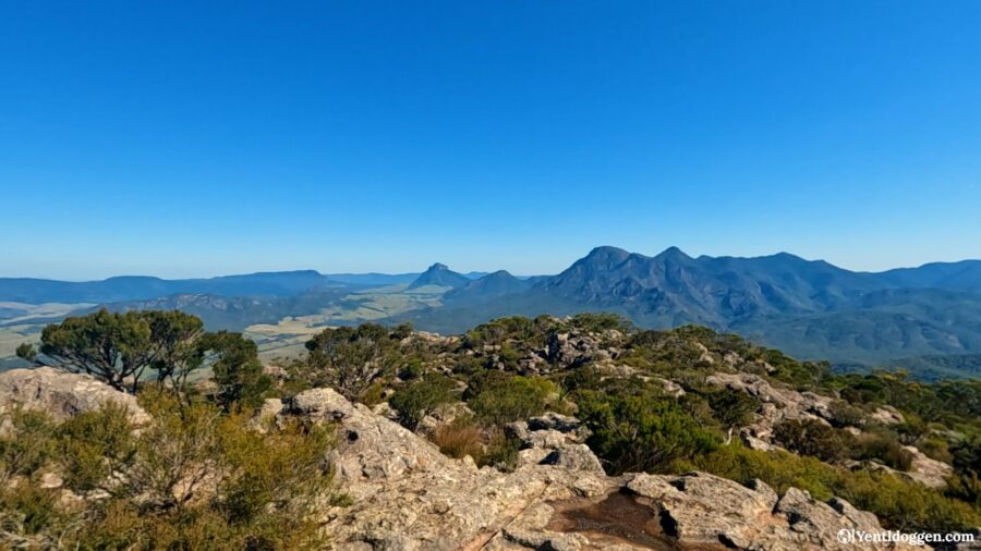
Mt Maroon Summit Route:
Allow 6 hours to return in daylight.
To reach the summit of Mount Maroon, start from the Cotswold car park and ascend gradually for about 400m. As you continue, the path becomes steeper, but follow the orange directional markers as they lead the way around this point. Follow the northeast ridge until you reach a point where the route turns right and descends into a narrow, steep, rocky gorge. At this point, you have reached the lower end of the ‘No waiting’ zone. After scaling the gorge, the path leads through the old campground, which is threatened by montane heath, and over rocky pavements until you reach the southern summit of Mount Maroon, which is at an altitude of 966m. Trying to find the last section of the path in the campground can be confusing, but if you head straight across from the warning sign at the top of the final rock climb, you will find the trail. The summit has incredible, uninterrupted views of Mt Barney and is a genuinely spectacular climb—the perfect warm-up climb to Mt Barney itself.
It is important to note that camping on the summit of Mt Maroon and within a 600m radius of the peak is strictly prohibited. This measure is in place to protect the threatened montane heath.
What’s next for us?
It turned out that leaving Mt Barney National Park was more difficult than we had anticipated. We had decided to spend an extra night after climbing Mt Maroon and considered climbing Mt Barney as well. However, we ultimately decided against it to ensure we had enough time for other activities. We were excited to visit three more national parks before returning to Moreton Island. Stay tuned to our website for further updates on our 2023 Greater Brisbane Road Trip!
Are you enjoying reading our travel guides? Please let us know in the comments below! If you need help or have questions about exploring this fantastic world, check out all our blogs and vlogs or contact us through the contact page. We are happy to help with all your travel needs and questions!
To keep up-to-date with future adventures and travel guides, follow us on Facebook or just simply check this website regularly. We can’t build this platform without our readers, so we thank you for your continued support. Stay tuned for many more adventures to come!